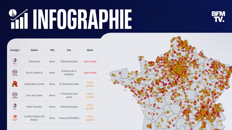
Almost a third of service stations continue to suffer total or partial shortages. According to the latest data released yesterday at 5:00 p.m., 31.3% of service stations were in difficulty.
Disturbances are always more marked in Hauts-de-France (42.6%), in Ile-de-France (41.9%), as well as in Centre-Val-de-Loire (44.7%), as shown below on our regularly updated map.
To find out which stations are affected in your city, you can also use our dedicated tool, by entering the postal code of your city. As of 11:30 a.m. this Thursday, October 13, 2,440 service stations are completely out of service and 1,773 are partially out of service.
Methodology
This search engine designed by the BFM Auto newsroom is based on data published by the Essence&Co application that brings together all service stations without fuel on an interactive map.
As specified by Essence&Co, each user of the application can report a low fuel to indicate that the fuel is no longer available, selecting the station where it is located. This operation can only be carried out within a radius of 3 kilometers around the service station. Data from our search engine will be updated regularly and will be freely accessible on BFM Auto.
Source: BFM TV


