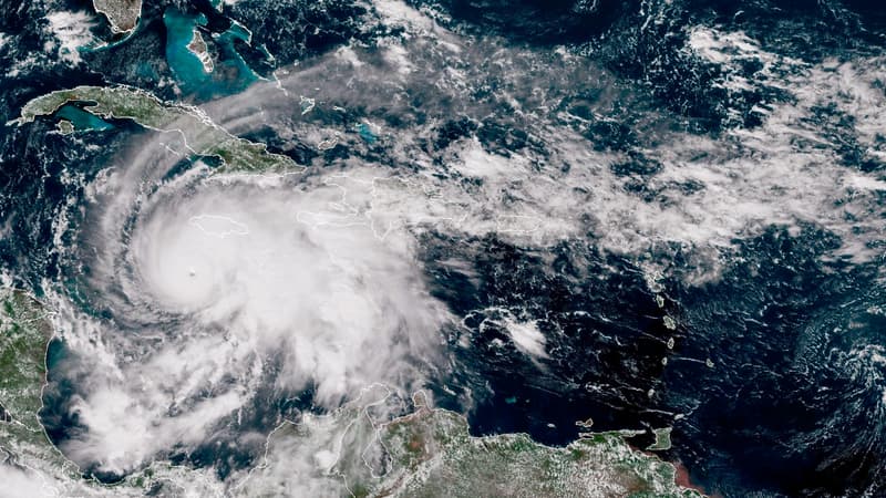
If it does not lose intensity, Hurricane Melissa will be the most powerful to make landfall this Tuesday, October 28 in Jamaica since meteorological monitoring began. With winds of up to 280 kilometers per hour, the category 5 hurricane, the highest, is already responsible for three deaths in the Caribbean country.
Three people died while preparing for the hurricane’s arrival, cutting branches and working on ladders. In recent days, four people have also died in Haiti and the Dominican Republic.
The expected damage is considerable in Jamaica. Especially since Melissa moves very slowly: at 4 km/h, slower than the average walking speed of a person. Consequence? Its effects may intensify as torrential rains and strong winds continue.
This slow pace of progress is an aggravating factor. When such strong winds come ashore and the systems bringing them move so slowly, it creates a steamroller effect that can have devastating consequences.
“A long period of time”
The hurricane, fueled by unusually warm waters in the Caribbean, is expected to dump between 50 and 63 centimeters of rain on parts of Jamaica. In three days the rains could exceed 1,000 liters of water per square meter. Waves and a rise in sea level of 4 to 5 meters are expected. As well as gusts greater than 300 km/h and average winds greater than 270 km/h.
The soils are already heavy, waterlogged after the rains of the previous weeks, which aggravates the risk of landslides, emphasizes the communications officer of the Jamaica Red Cross, Esther Pinnock.
Precarious habitats run the risk of not resisting. “I don’t think any infrastructure in this region could withstand a Category 5 hurricane, so there could be significant destruction,” Prime Minister Andrew Holness said on CNN, calling on residents to evacuate the highest-risk areas.
Jill Trepanier, an expert in hurricane climatology at Louisiana State University, points out the danger of hurricanes like Melissa. “It could be prolonged storm surge. It could be heavy rain over a long period of time, and the basin can’t handle it. It could be winds at extreme speeds over a long period of time,” he warns.
Stagnant storms that increase
The scientist wrote a report on stalled storms last year, noting that these types of events in the Caribbean usually occur in October, near the coast. Normally, stagnant storms die by absorbing cold water from the deep sea. But Melissa was out of the ordinary: It intensified while stagnating in the same spot, a sign that the water was so warm and the heat so deep that it prevented this usual self-destruct effect.
“It is a somewhat terrifying situation,” says the expert.
According to James Kossin, a former climatologist at the National Oceanic and Atmospheric Administration (NOAA), the data clearly shows that the number of stalled storms is increasing.
One possible explanatory factor is “Arctic amplification.” When global warming reduces the temperature difference between the planet’s low and high latitudes, weakening the winds that normally drive hurricanes. But he acknowledges that more research is needed to confirm a causal link.
The last major hurricane to make landfall in Jamaica was Hurricane Gilbert in September 1988, which killed 40 people and caused enormous damage.
Source: BFM TV


