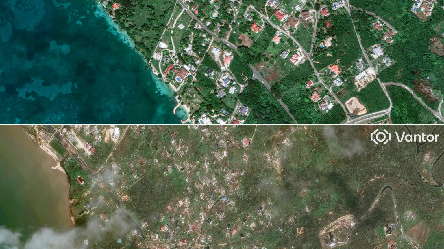
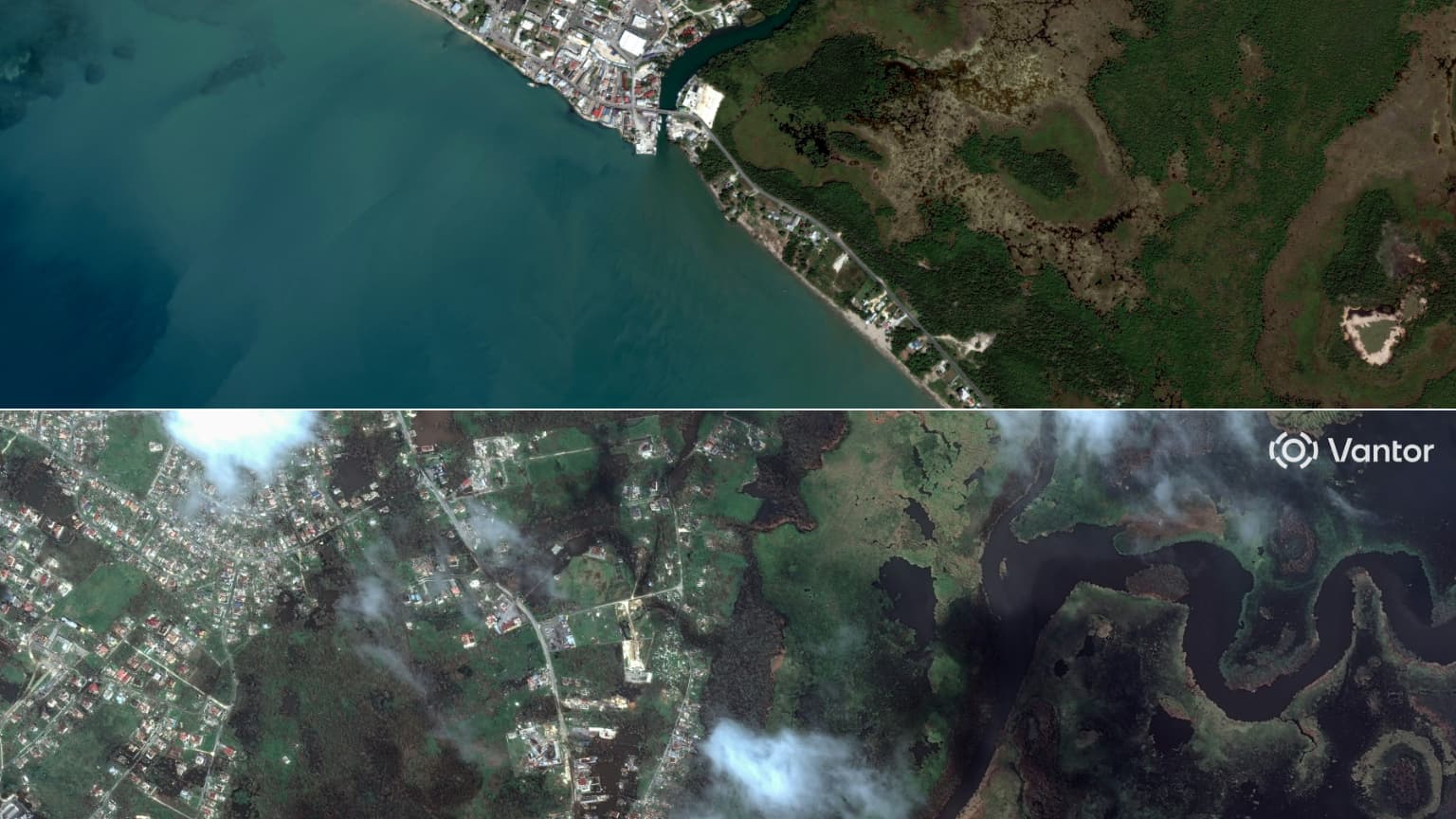
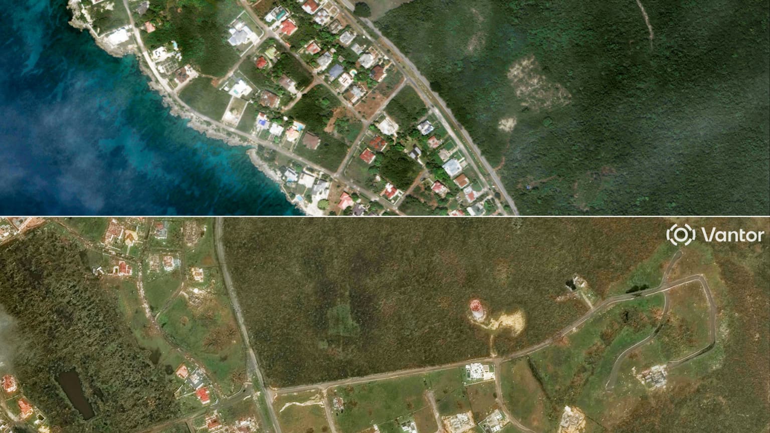
Houses demolished, roofs knocked down, roads flooded and littered with debris… Two days after the passage of Melissa, on Tuesday, October 28, Jamaica confirmed, on the afternoon of Wednesday, October 29, the magnitude of the damage caused by one of the most powerful hurricanes ever recorded.
The first satellite images taken before and after the natural disaster show the change in landscape, especially in the west and center of the island.
The very powerful Category 5 Hurricane Melissa passed through Jamaica on Tuesday October 28 causing torrential rains with devastating winds of almost 300 km/h.
“I have never seen anything like it”
After the hurricane, the violent gusts that crossed Jamaica gave way to devastated streets and impassable roads. “I’ve experienced three or four hurricanes here. I’ve never seen anything like it. It’s never been this bad,” Andrew Houston Moncure, owner of a seaside resort in Bluefields, on the southwest coast, where Melissa made landfall, told AFP.

According to local media, the hurricane in particular tore off the roof of a hospital in Saint Elizabeth, in the west of the country. In Saint Catherine, central Jamaica, the Copper River overflowed its banks and strong winds tore down fences and roofs.

The east of the island, where the capital Kingston is located, appears to have been less affected, according to a resident who spoke to AFP. “I have the impression that the worst is over,” he told the news agency.
The hurricane is heading towards the Bahamas
Category 5, Hurricane Melissa is one of the most powerful hurricanes on recordand the worst to hit Jamaica since weather records began. In order of comparison, Hurricane Katrina, which devastated New Orleans in the United States 20 years ago and caused more than 1,000 deaths, was weaker.
After losing some power and being downgraded to category 4, Melissa left Jamaica and this Wednesday affected Cuba and Haiti, causing the death of at least 20 people in the former French colony.
The hurricane headed toward the Bahamas, where a dangerous storm is expected, and will then head toward Bermuda, where it should arrive Thursday night.
Source: BFM TV


